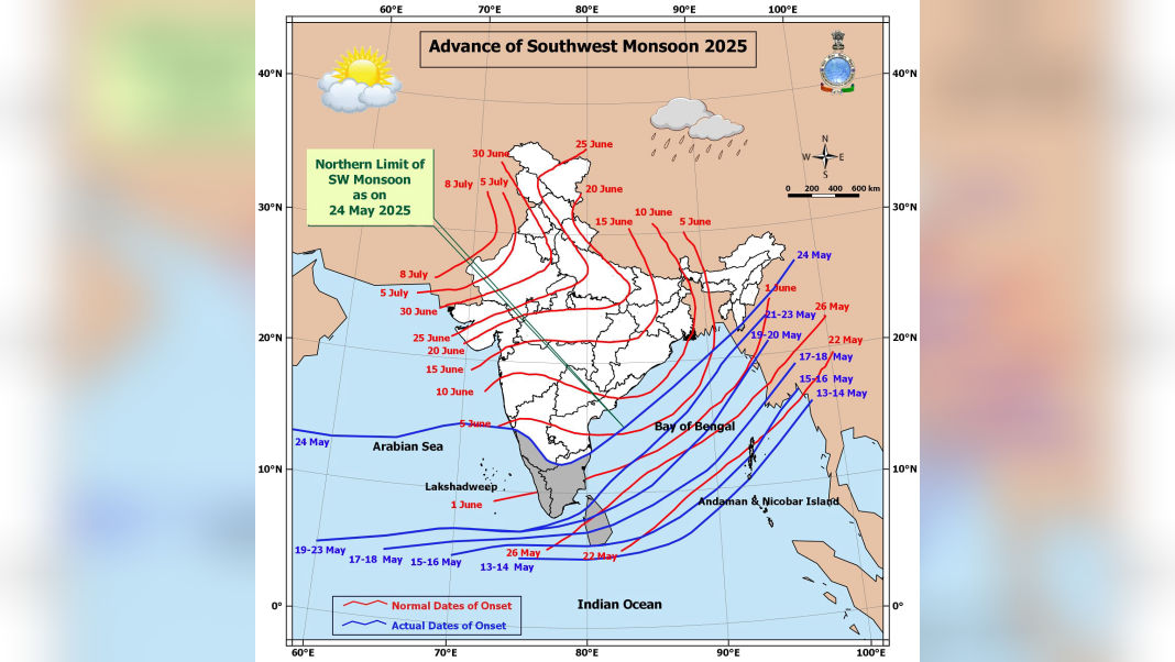
Guwahati, May 25: The Southwest Monsoon has made further progress into several parts of the country, the India Meteorological Department (IMD) confirmed on Sunday. The seasonal weather system has now extended into additional areas of the westcentral and eastcentral Arabian Sea, parts of Karnataka, the entire state of Goa, segments of Maharashtra, and portions of the westcentral and northern Bay of Bengal.
Rainfall has also reached parts of the Northeast, including Mizoram, Manipur, and Nagaland, signalling the early spread of the monsoon in the eastern corridor.

According to the IMD, the Northern Limit of Monsoon (NLM) — which marks the leading edge of monsoonal activity — now passes through a wide swath of coordinates and cities:
15.5°N/55°E, 15.5°N/60°E, 16°N/65°E, 16.5°N/70°E, Devgad, Belagavi, Haveri, Mandya, Dharmapuri, Chennai, 15°N/83°E, 18°N/87°E, 20°N/89°E, Aizawl, Kohima, 26.5°N/95°E, and 27°N/97°E.
In its latest bulletin, the IMD stated that conditions remain favourable for the further advance of the monsoon over the next three days. The rain-bearing system is expected to cover more parts of the central Arabian Sea, remaining regions of Karnataka including Bengaluru, additional districts of Maharashtra including Mumbai, and parts of Andhra Pradesh and Tamil Nadu. It will also push further into the Bay of Bengal and more northeastern states.

The advance marks a timely onset of the monsoon, which plays a critical role in India’s agriculture and water supply. Farmers, especially in rain-fed areas, are preparing for the upcoming Kharif cropping season. Meanwhile, urban administrations are making preparations to manage the usual challenges that come with early monsoonal rains, such as waterlogging and traffic disruptions.
The IMD continues to monitor the system’s progress closely and will issue regular updates as the monsoon moves further inland.


