

GUwahati, May 14: The Northeast Frontier Railway (NFR) is going high-tech to tackle one of its most challenging stretches—the Lumding–Badarpur Hill Section—using advanced surveying and monitoring tools to boost safety and resilience in the disaster-prone corridor.
This critical 80-km stretch, spanning through the rugged hills of Dima Hasao and Cachar districts, links Assam’s Barak Valley with Tripura, Mizoram, and Manipur, making it a strategic lifeline for Northeast India. However extreme monsoons and tough terrain have long plagued the route with landslides, drainage issues, and embankment instability.
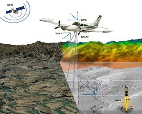
To confront these hazards, NFR has rolled out a comprehensive aerial and geophysical survey between KM-45 and KM-125. The operation features drone-based LiDAR (Light Detection and Ranging), high-resolution aerial imaging, and thermal mapping, capturing ultra-detailed terrain data with 2 cm resolution LiDAR orthophotos and Digital Elevation Models.
Ground investigations have been equally high-tech. NFR has deployed Ground Penetrating Radar (GPR), Transient Electromagnetic Surveys, Electrical Resistivity Tomography (ERT), and Seismic Refraction Testing (SRT). These tools pinpoint underground faults, water-logged zones, and weak embankments, enabling proactive landslide mitigation and infrastructure reinforcement.
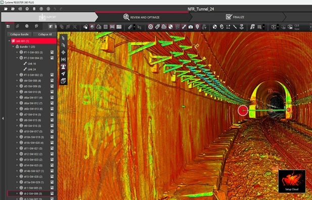
Special attention is being given to tunnels—especially a 750-meter tunnel at Location 20—where Terrestrial Laser Scanning (TLS) is being used to detect even sub-centimetre structural shifts, joint dislocations, and water seepage. Additionally, drone-mounted GPR systems are scanning bridge and tunnel approaches to detect hidden anomalies like voids or soil discontinuities that could lead to failure.

The safety strategy doesn’t stop at the surface. NFR is also creating GIS-based landslide susceptibility maps by analyzing slope angles, soil types, vegetation, and water flow patterns—allowing risk zones to be classified from low to high vulnerability.
By combining aerial intelligence, geophysical diagnostics, and remote sensing, NFR is transforming how it monitors, maintains, and protects this crucial hill section. This bold integration of modern technology is setting a new standard for railway safety and infrastructure resilience in Northeast India, especially as the monsoon season looms