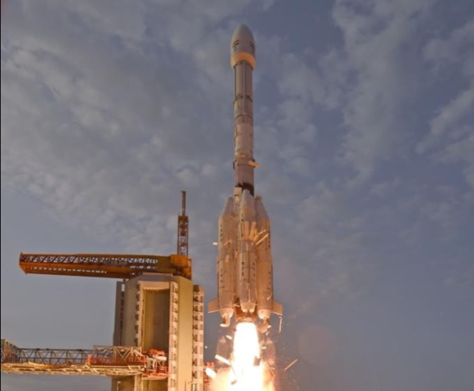
Sriharikota (Andhra Pradesh), July 30: India and the US on Wednesday marked their maiden space collaboration with the successful flight of a GSLV rocket that placed an earth observation satellite, jointly developed by ISRO and NASA, in a precise orbit in what was described as an “outstanding success” by the Indian space agency.
ISRO’s GSLV F-16 injected NISAR–NASA-ISRO Synthetic Aperture Radar satellite, into the intended Sun Synchronous Polar Orbit (SSPO), after a flight of about 19 minutes and around 745 km, marking the culmination of a decade-long cooperation between the top two space agencies of the world.
“I am extremely happy to announce that GSLV F-16 successfully injected the NISAR satellite into intended orbit,” ISRO Chairman V Narayanan said about the 102nd launch from here.
Reportedly, Wednesday’s mission was the world’s most expensive at an estimated USD 1.5 bn. Also, this was the first GSLV mission to the SSPO and till date, all the GSLV missions have been going to Geosynchronous Transfer Orbit (GTO).
“And being the SSPO mission, several analyses and studies were carried out to make this mission a grand success.” Cryogenic upper stage corrections and a host of mission simulations were carried out very systematically and meticulously, Narayanan added.
“All the vehicle system performances were quite normal as expected and as predicted. Today, we achieved the intended orbit. Actually we have got an orbit with a dispersion (deviation from desired orbit) of less than 3 km as against the permissible level of 20 km…all parameters are as expected,” he said.
“NISAR is an all-weather day and night imaging satellite that will scan the entire earth at a 12 day interval. The satellite integrates ISRO’s S-band synthetic aperture radar with NASA’s L-band SAR payload and 12 metre unfurlable antenna to become a first of its kind dual frequency SAR satellite,” Narayanan, also Secretary, Department of Space, added.
Deputy Associate Administrator at NASA, Casey Swails said it was an incredible decade culminating in this moment from the technical collaborations, the cultural understandings, getting to know each other building that team across continents, time zones.
“This mission is truly a pathfinder, not just in regards to our technical collaborations because those are truly incredible but earth science mission is one of a kind which really shows the world what the two nations can do. But more than that it is really a pathfinder for the relationship building across our two nations, across India and the United States building upon decades of collaborations that already existed,” she added.
Earlier, at the end of the 27.30 hour countdown, the 51.7 metre tall launch vehicle carrying the 2,393 kg satellite majestically lifted-off from the second launch pad at the Satish Dhawan Space Centre, here, situated about 135 km east of Chennai at a prefixed time of 5.40 pm.
Post the separation from the rocket, the scientists would embark on commissioning the satellite which would take “several days” to be positioned and meet the mission objectives.
According to ISRO, the S-band Radar system, data handling and high-speed downlink system, the spacecraft and the launch system are developed by the national space agency. The L-band Radar system, high speed downlink system, the Solid State Recorder, GPS receiver, the 9m Boom hoisting the 12m reflector are delivered by US-based National Aeronautics Space Administration (NASA).
“Further, ISRO is responsible for the satellite commanding and operations. NASA will provide the orbit maneuver plan and RADAR operations plan. NISAR mission will be aided with ground station support of both ISRO and NASA for downloading of the acquired images, which after the necessary processing will be disseminated to the user community,” it said.
The data acquired through S-band and L-band SAR from a single platform will help the scientists to understand the changes happening to Earth.
According to ISRO, the NISAR mission’s primary objectives are to study land and ice deformation, land ecosystems, and oceanic regions in areas of common interest to the US and Indian scientific communities.
The mission would help in measuring the woody biomass, track changes in the extent of active crops, understand the changes in wetlands extent among others.
The mission life of NISAR is 5 year.
NASA said the data from NISAR mission would provide critical insights to help governments and decision-makers plan for natural and human-caused hazards. NISAR can help with hazard-monitoring efforts and potentially give decision- makers more time to prepare for a possible disaster. (PTI)


