
By Satyabrat Borah
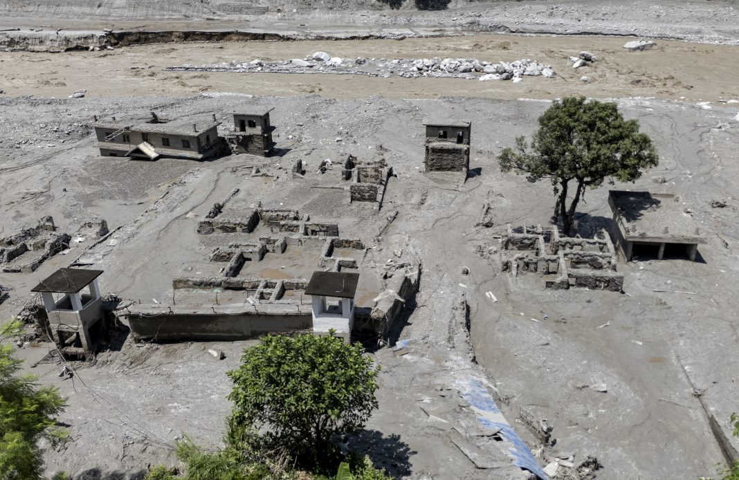
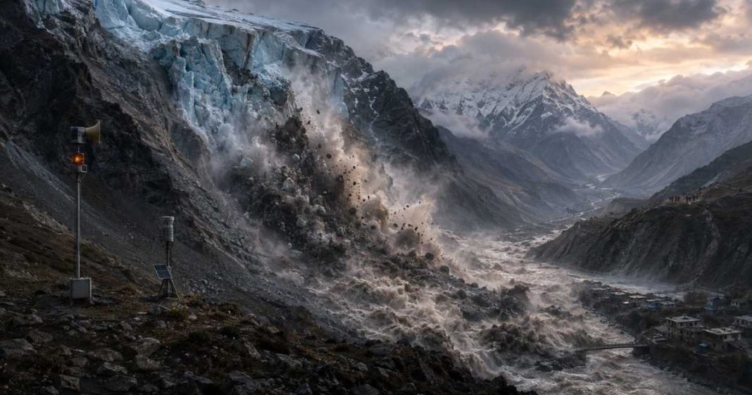
The high peaks of the Himalaya have long stood as silent guardians over Asia, holding vast reservoirs of ice that feed the great rivers sustaining over a billion people. Today those frozen giants are turning unpredictable and dangerous. Climate change is warming the highest altitudes faster than the global average, causing high mountain glaciers to melt, fracture, and collapse with little warning. A devastating catastrophe recently swept through a Himalayan river valley along the Nepal border, bringing this reality into sharp focus. A massive combination of bedrock and glacial ice detached from a lofty peak, hurtling down the mountain and transforming into a churning torrent of mud, water, and debris. It swallowed entire villages, wiped out vital infrastructure, and claimed scores of lives in a matter of minutes.
Events like this are no longer isolated anomalies. All across the world, frozen landscapes are showing signs of severe stress. From the fjords of Greenland and Alaska to the valleys of the Swiss Alps and the Southern Alps of New Zealand, glaciers are losing their stability. When these frozen masses break apart high above human settlements, the results are swift and catastrophic. The volume of material involved in the recent Himalayan slide was staggering, equivalent to dropping dozens of ancient stone pyramids straight down a vertical face. The sheer kinetic force generated by that fall instantly converted ice to water, creating an overwhelming surge that erased everything in its path.
Understanding why these disasters happen requires looking closely at how glaciers behave when temperatures rise. High altitude glaciers sit precariously on steep rock faces, held in place by freezing temperatures and structural support from the rock beneath them. As air temperatures climb, liquid water trickles deep into cracks within the ice and the underlying stone. This water creates immense pressure, acting as a lubricant that loosens the glacier from its foundation. Eventually, the structural integrity fails completely. Entire sections of ice and rock slide free, gaining immense velocity as they plunge down thousands of feet.
The immediate danger extends far past the initial impact zone. When a massive slide strikes a valley floor, it frequently blocks the natural flow of rivers, forming an unstable temporary dam. Water builds up rapidly behind this barrier until the pressure becomes too great. The dam gives way, releasing a wall of water and debris that rushes downstream with unbelievable force. This compound hazard turns a local rockfall into a valley wide disaster, threatening communities located many miles away from the original collapse.
Given the immense power of these events, scientists around the world are working tirelessly to determine if future collapses can be accurately predicted. The task is extraordinarily complex, requiring a blend of satellite monitoring, ground sensors, and deep local knowledge. Some recent successes offer a glimmer of hope. In the Swiss Alps, researchers and authorities successfully predicted the failure of a troublesome glacier above a mountain village. Through meticulous monitoring of subtle ground movements and increasing rockfall activity, scientists identified clear warning signs months before the final collapse. Local officials organized a timely evacuation, ensuring that not a single resident lost their life when twenty million tons of debris eventually buried the town.
Replicating that success in regions like the Himalaya presents enormous hurdles.
European mountain ranges benefit from dense infrastructure, easy physical access, and extensive financial resources dedicated to hazard monitoring. Technicians can readily install high precision sensors, ground radar systems, and automated weather stations right next to suspect glaciers. The Himalaya, by contrast, spans thousands of miles of extremely rugged, remote, and high altitude terrain. Reaching these sites on foot can take days, and maintaining delicate electronic equipment in subzero winds and heavy snowfall is a constant struggle.
Satellite technology has helped narrow this gap considerably. Modern satellite imaging allows glaciologists to track changes in glacier surface elevation, monitor the expansion of meltwater lakes, and detect subtle speed shifts in ice movement from orbit. Advanced radar satellites can penetrate cloud cover and operate day or night, providing a continuous stream of data across vast mountain ranges. Even so, satellites have limitations. A satellite might only pass over a specific mountain face every few days, leaving critical blind spots during rapid failure events. Furthermore, subtle warning signs that occur beneath the ice or deep within the bedrock remain invisible to sensors orbiting miles above the Earth.
Predicting a glacial collapse also depends heavily on the unique characteristics of each individual glacier. Some ice masses give clear warnings before they fail, accelerating gradually over weeks or showing visible cracks on their surface. Others show virtually no outward signs of distress until the moment they drop. A glacier resting on stable granite might behave entirely differently from one perched on crumbly shale or loose sediment. Variations in local precipitation, thermal structure, and bedrock geometry mean that a monitoring strategy that works perfectly for one peak may completely fail on another.
The human element is just as critical as the scientific technology. A early warning system is only as good as the communication network connecting scientists to local communities. In remote Himalayan valleys, roads are sparse and cell service can be spotty or nonexistent. Translating complex scientific assessments into timely, actionable instructions for residents requires strong local governance and deeply trusted community networks. If an alert is issued but fails to reach a village in time, or if residents do not know how to respond safely, the best predictive science in the world cannot prevent tragedy.
Efforts are currently underway across Nepal and neighboring countries to build better resilience against glacial hazards. Glaciologists are partnering with international research teams to map out high risk zones, identifying which valleys face the greatest potential exposure to outburst floods and ice avalanches. Researchers are placing automated sensors along vulnerable river channels to detect sudden changes in water levels or seismic activity associated with landslides. These sensors can automatically trigger sirens in downstream villages, giving residents precious minutes to reach higher ground.
Community involvement is proving to be one of the most effective tools in managing these risks. Local mountain residents often notice subtle changes in their environment long before external researchers do. They observe new cracks opening in high pastures, hear unusual noises from the ice above, or spot sudden changes in river color and flow. Training local observers to report these signs creates a valuable network of real time ground intelligence that complements high tech satellite tracking.
The broader challenge lies in the relentless pace of global climate change. Even if every high risk glacier in the world were outfitted with state of the art monitoring gear, the underlying driver of instability would remain unaddressed. Mountain glaciers are fundamental indicators of global climate health. As greenhouse gas emissions continue to warm the atmosphere, glaciers will continue to lose mass and structural cohesion. The zero degree temperature threshold is pushing higher up mountain slopes every year, thawing deep permafrost that has bound loose rock faces together for millennia.
This thawing of high altitude permafrost is a growing concern for geologists. Permafrost acts as a structural glue within high mountain peaks. When it melts, entire mountain walls lose their stability, increasing the likelihood that huge sections of rock will fall and take overlying glaciers with them. This process creates a far more volatile environment where massive cascade hazards become increasingly common.
The transformation of these mountain environments also carries profound long term economic and social consequences.
Mountain communities rely heavily on stable river systems for agriculture, drinking water, and hydropower generation. Frequent glacial collapses and unpredictable flooding destroy hydroelectric dams, ruin agricultural terraces, and wash away vital transit corridors. Replacing this infrastructure costs hundreds of millions of dollars, straining the national budgets of developing nations and forcing vulnerable populations to relocate.
Tourism and mountaineering, which form the financial backbone of many Himalayan regions, are similarly threatened. Climbers and trekkers face growing risks from falling ice and unpredictable rockslides on routes that were once considered safe. Local guides and hospitality workers face economic ruin when entire valleys are closed off due to safety concerns or catastrophic damage.
Developing comprehensive solutions requires sustained international collaboration. Wealthier nations with advanced scientific capacity must share technology, funding, and expertise with mountain nations facing the brunt of these climate impacts. Joint research initiatives are helping build local scientific capacity in Nepal, India, Pakistan, and Bhutan, training a new generation of local glaciologists who understand the unique physical and cultural nuances of their home regions.
Improving global climate policy remains the ultimate preventive measure. Mitigating the severity of future mountain hazards depends directly on curbing global carbon emissions and limiting global temperature rise. Every fraction of a degree of warming that is avoided helps preserve the structural integrity of remaining mountain ice, reducing the frequency and magnitude of future collapses.
Scientists are making real progress in their ability to understand and anticipate high mountain hazard events. The combination of satellite observation, numerical modeling, and ground level monitoring is far more sophisticated today than it was even a decade ago. While absolute prediction of every single collapse remains out of reach, scientists are steadily improving their ability to identify high risk situations and give communities a fighting chance. Protecting those who live in the shadow of these icy giants will require an unyielding commitment to both cutting edge science and meaningful climate action.